Installation Guide
0 mins to read
Intelligent Zoning App and API User Guide
Installation Guide
0 mins to read
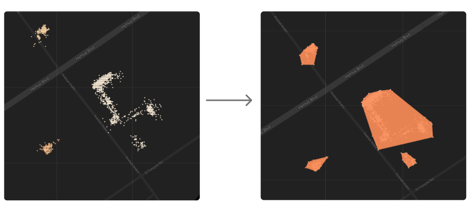
Learn more about Intelligent Zoning, an experimental tool that uses vehicle stop history to automatically create new zones in MyGeotab. Intelligent Zone detection uses a clustering algorithm called Density-Based Spatial Clustering Applications with Noise (DBSCAN) to find core samples of high density stop areas and expand clusters from them. This allows areas with high stop frequency to be recorded and then expanded based on your fleet movement around the area.
An Experiment in the Analytics Lab Add-In
Version-1 Lab Release: December 2020 Last document update: March 2021
*Now graduated to Active Insights.
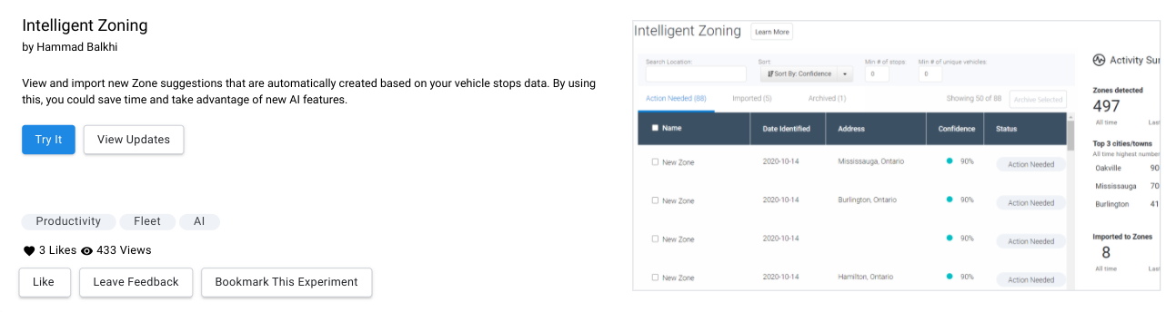
Intelligent Zoning
An Experiment in Analytics Lab
What is Intelligent Zoning
Intelligent Zoning is an experimental tool that uses vehicle stop history to learn and automatically create new zones in MyGeotab. Intelligent Zoning is the latest in a suite of experimental tools available from the Analytics Lab inside MyGeotab.
✱ NOTE: Intelligent Zoning is available to end users as an App, and an API (via API Explorer on the Analytics Lab platform).
Why do you need it?
Fleets who track operational activity such as visits to customer locations, fuel stations, distribution points, and other areas of interest currently do so by creating zones manually. While zones are critical for keeping up with day-to-day operations, creating them manually can be time-consuming, error-prone, and quickly outdated.
How does it work?
Intelligent Zone detection uses a clustering algorithm called DBSCAN or Density-Based Spatial Clustering Applications with Noise to find core samples of high density stop areas and expand clusters from them. This allows areas with high stop frequency to be recorded and then expanded based on your fleet movement around the area. Not only does this reduce the time needed to create zones, but zones are created more effectively as they correspond to the patterns of movement of your fleet.
Intelligent Zoning helps you to gain insight and improve productivity by creating and classifying zones, automatically.
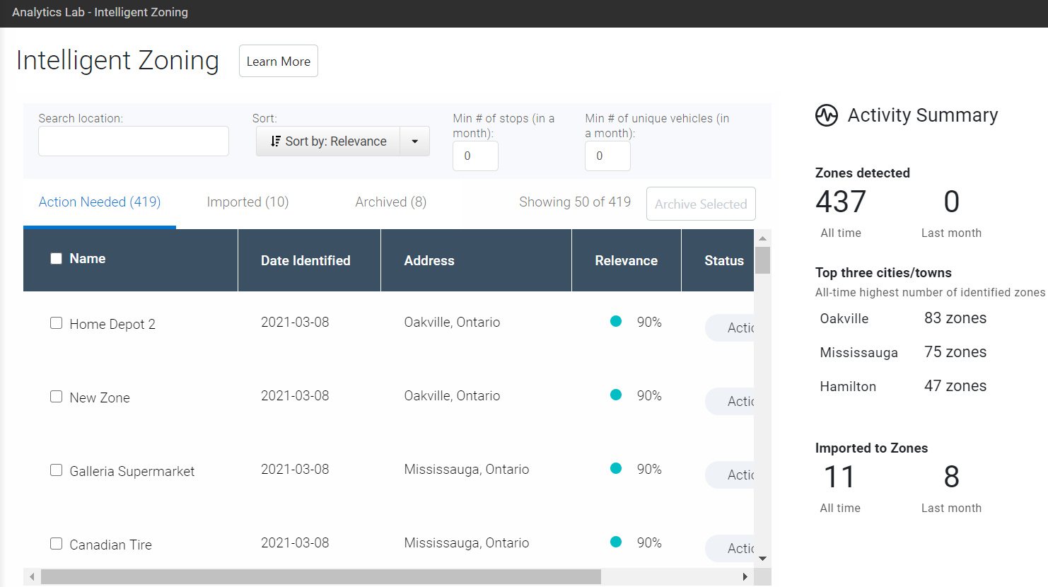 |
Zones are ranked according to the number of vehicle stops, then assigned a Relevance percentage for analysis.
! IMPORTANT: Although all fleet accounts are eligible to use Intelligent Zoning experiment, some Government and Public Sector fleets may be unable to access it. For more information, Resellers can contact their Partner Account Manager, and Customers can reach out to Support through their standard communication channel.
How to use the Intelligent Zoning Experiment
Follow the steps below to review and import zones recommended by the app.
✱ NOTE: For demonstration purposes, the steps below this document include screenshots of the experiment utilizing an internal Geotab database.
1 | Install and launch the Add-in by navigating to Analytics Lab on the MyGeotab main menu. ✱ NOTE: You must have Administrator security clearance to use the Intelligent Zoning App.  |
2 | On clicking the Try It icon on the catalog page, the landing page of the app will appear.  |
3 | Click a zone from a highlighted row. Use the checkbox to view multiple zones on the map at the same time. |
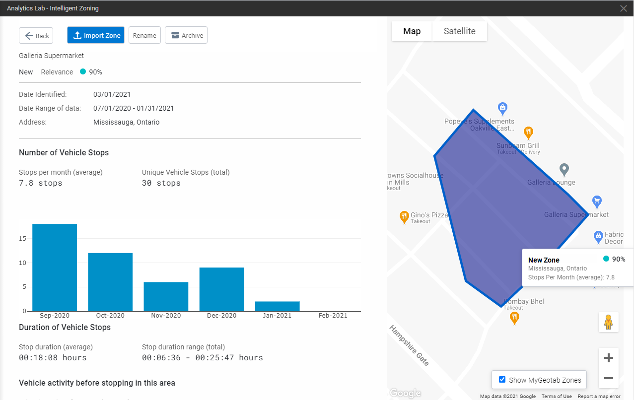
4 | In the zone details view, use the Show MyGeotab Zones toggle to show/hide your existing Zones. |
5 | Once you are satisfied with the details on the recommended Zone, and you would like to import the Zone to your MyGeotab account, click on the Import Zone button.  Confirm the action to complete the import. 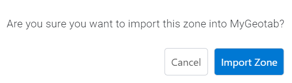 |
6 | Once the Zone is successfully imported to your MyGeotab account, click on the Edit Zone button to view the Zone in more detail. 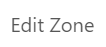 |
7 | View and edit Zone Details, then click Save.  |
All Zones are created with the following default parameters:
Cluster Size : 0.25 KMs
Minimum Number of Stops in Each Cluster : 30
Stop duration between - 300 to 36000 seconds
Stops made during hours between : 00:00 to 23:59 Hours
Stops made historically between : Last Six Months
Vehicle Types - LDT, MDT, HDT, Car, MPV, Other, Unknown
Follow the steps below to modify the parameters and create customized Zones:
✱ NOTE: Please allow upto 24 hours to refresh the app.
1 | Open the Analytics API Explorer experiment by navigating to Analytics Lab on the MyGeotab main menu. 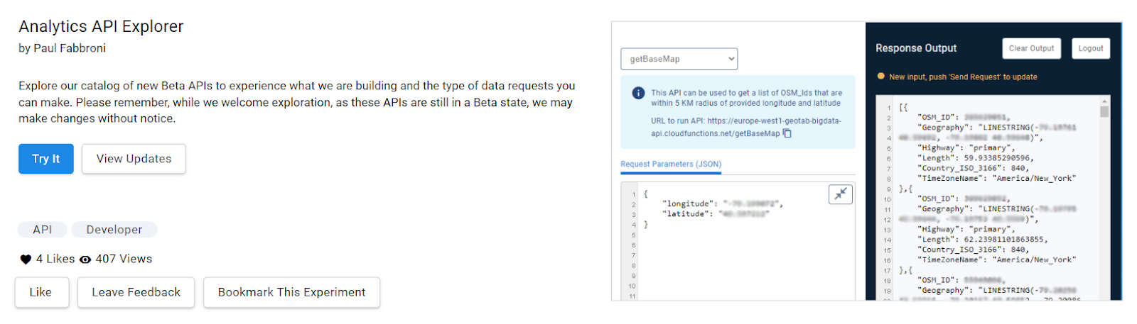 |
2 | On clicking the Try It icon on the catalog page, the landing page of the API Explorer app will appear.. 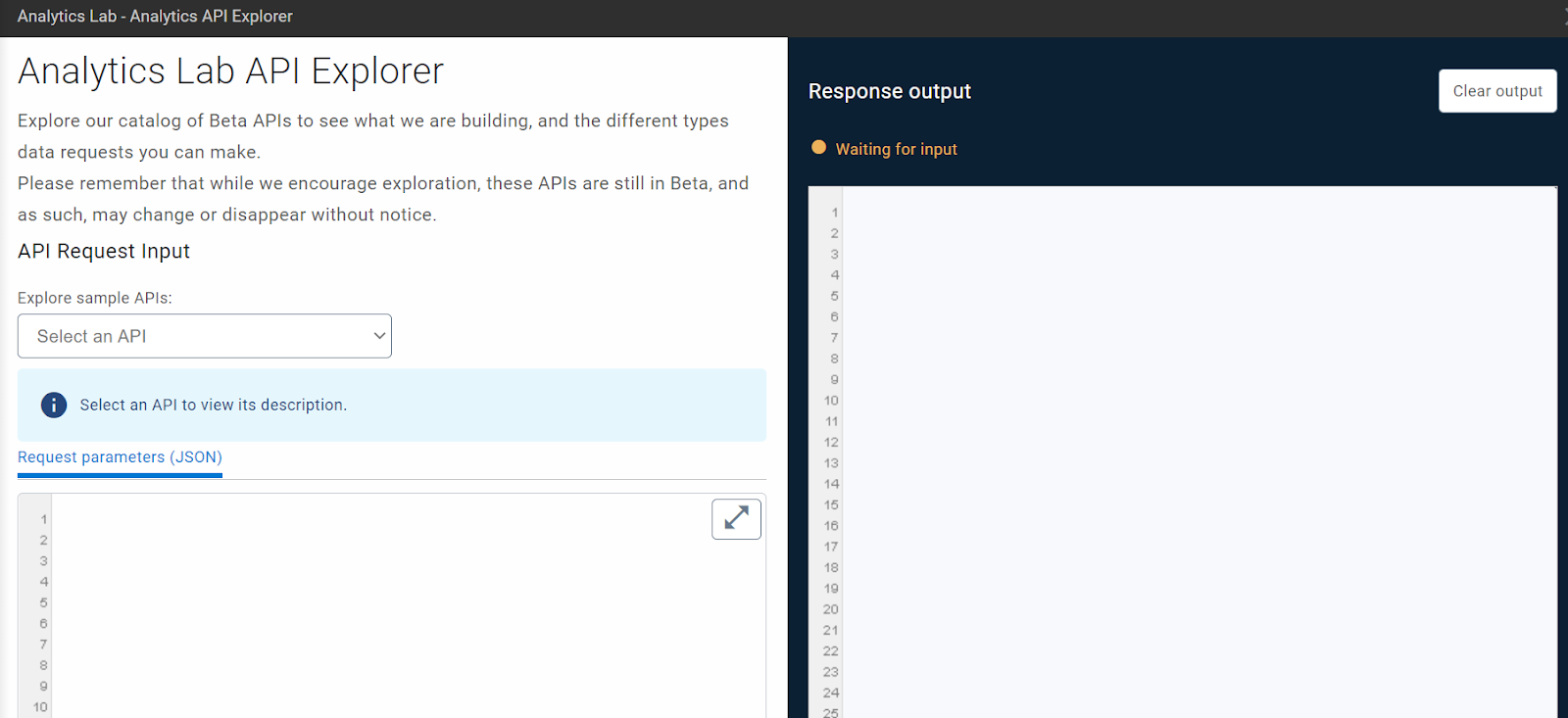 |
3 | Under the API Request Input dropdown, select Updating zone configuration. 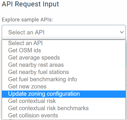 |
4 | Update the parameters as desired. { "database": "databasename", "sessionId": " ", "userName": " ", "serverName": "", "stopLower": 300, "stopUpper": 36000, "clusterSize": 0.25, "clusterMembers": 30, "timeStart": "00:00", "timeStop": "23:59", "includeSharedDevices": "true", "dateStart": "2020-06-01", "dateStop": "2020-12-01", "vehicleType": "LDT,MDT,HDT,Car,MPV,Other,Unknown" } |
5 | Click Send request to complete updating the Zone list configuration.  Once the request is successfully submitted, a toast message appears in the Response output panel. |
API documentation
Learn more!
As we continue to improve our experiments, your feedback is valued. Send us your feedback or questions by clicking Leave Feedback and completing our experiment feedback form.
See what’s happening in the Analytics Lab Community, and join the group today.
Version History
Version | Date | Owner | Version |
1.0 | March 2021 | Data Product Discovery team | Initial draft |